Render by Atchain
Shenzhen, China
2020 - TBC
Design
Huanggang Port Area Masterplan
Render by Atchain
Render by LMNB
Courtesy of ZHA, render by Atchain
Render by LMNB
Render by Atchain
01
02
03
04
05
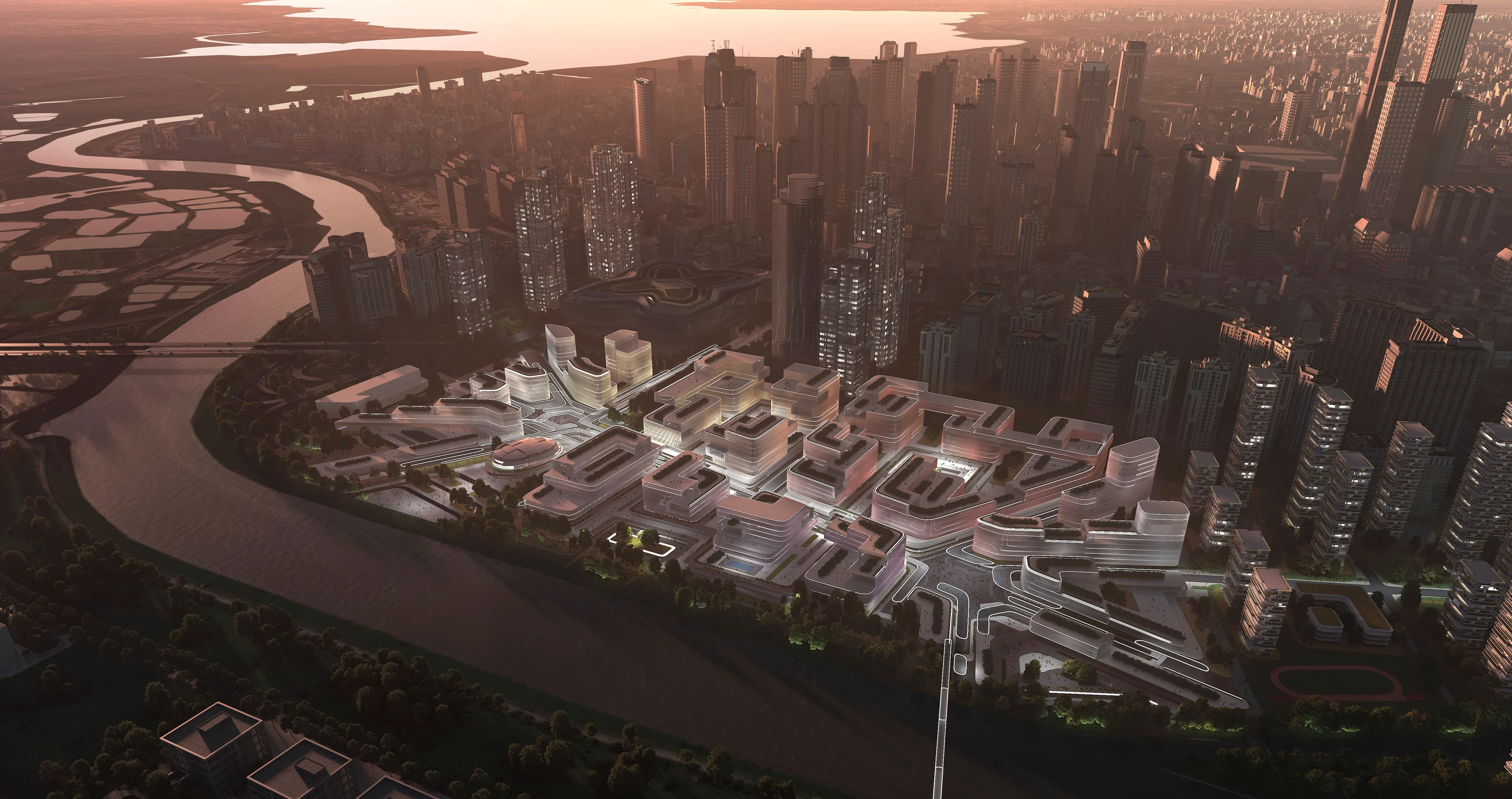
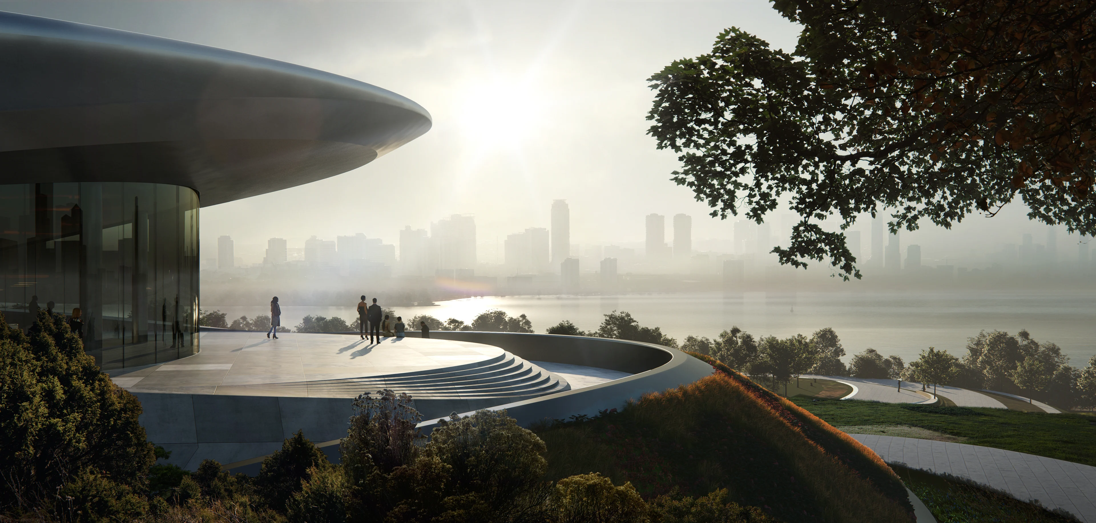
The future Huanggang Port Area masterplan in Shenzhen, China will be an important node of the Guangzhou-Shenzhen Science and Technology Corridor, creating a hub of scientific research and collaboration in industries such as microelectronics, material development, artificial intelligence, robotics, and medical sciences.
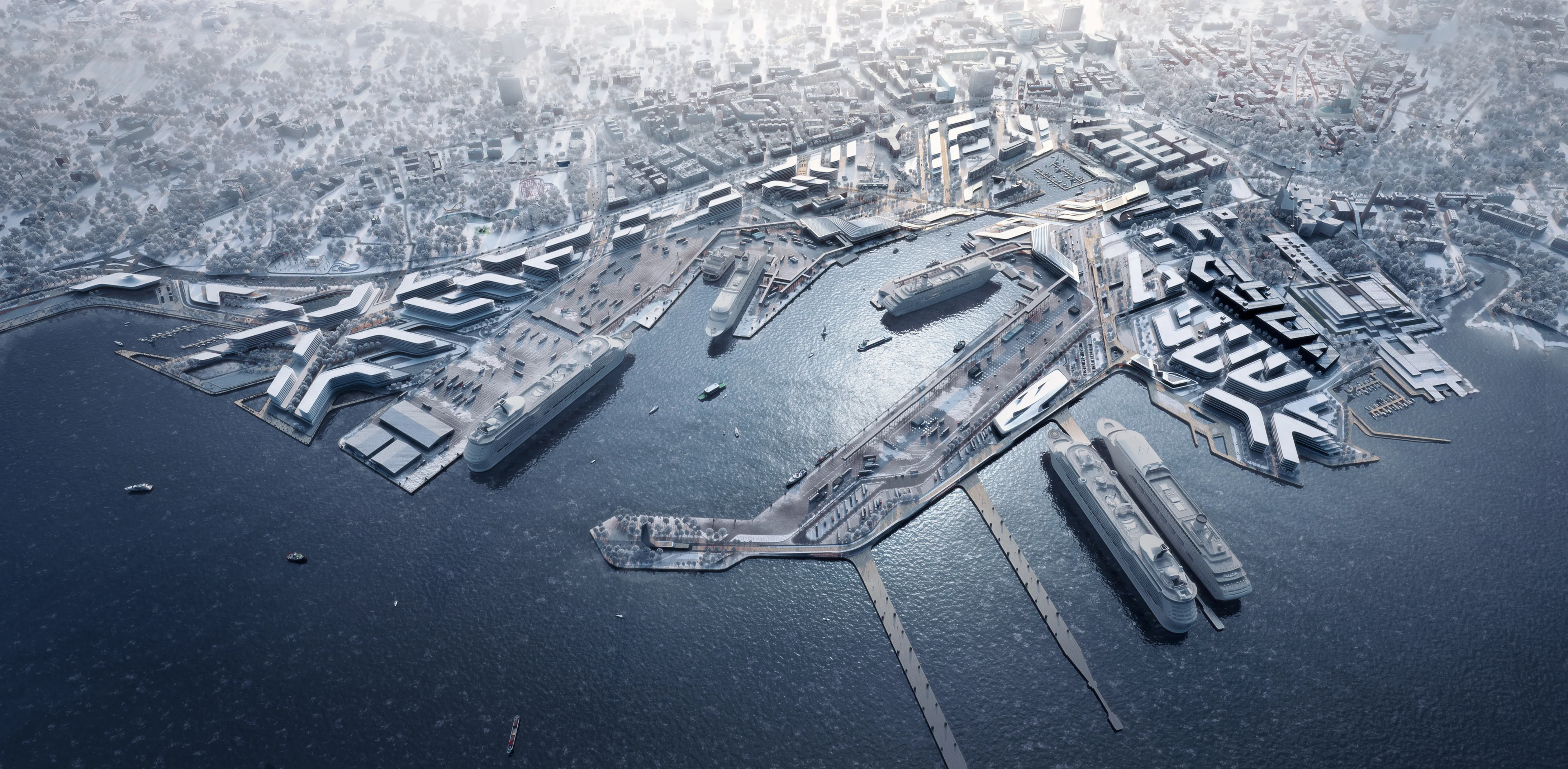
Reconstruction of the Huanggang Port building will enable the port’s 1.67 square kilometres of parking lots and cargo inspection areas to be redeveloped as a national centre for technology innovation.
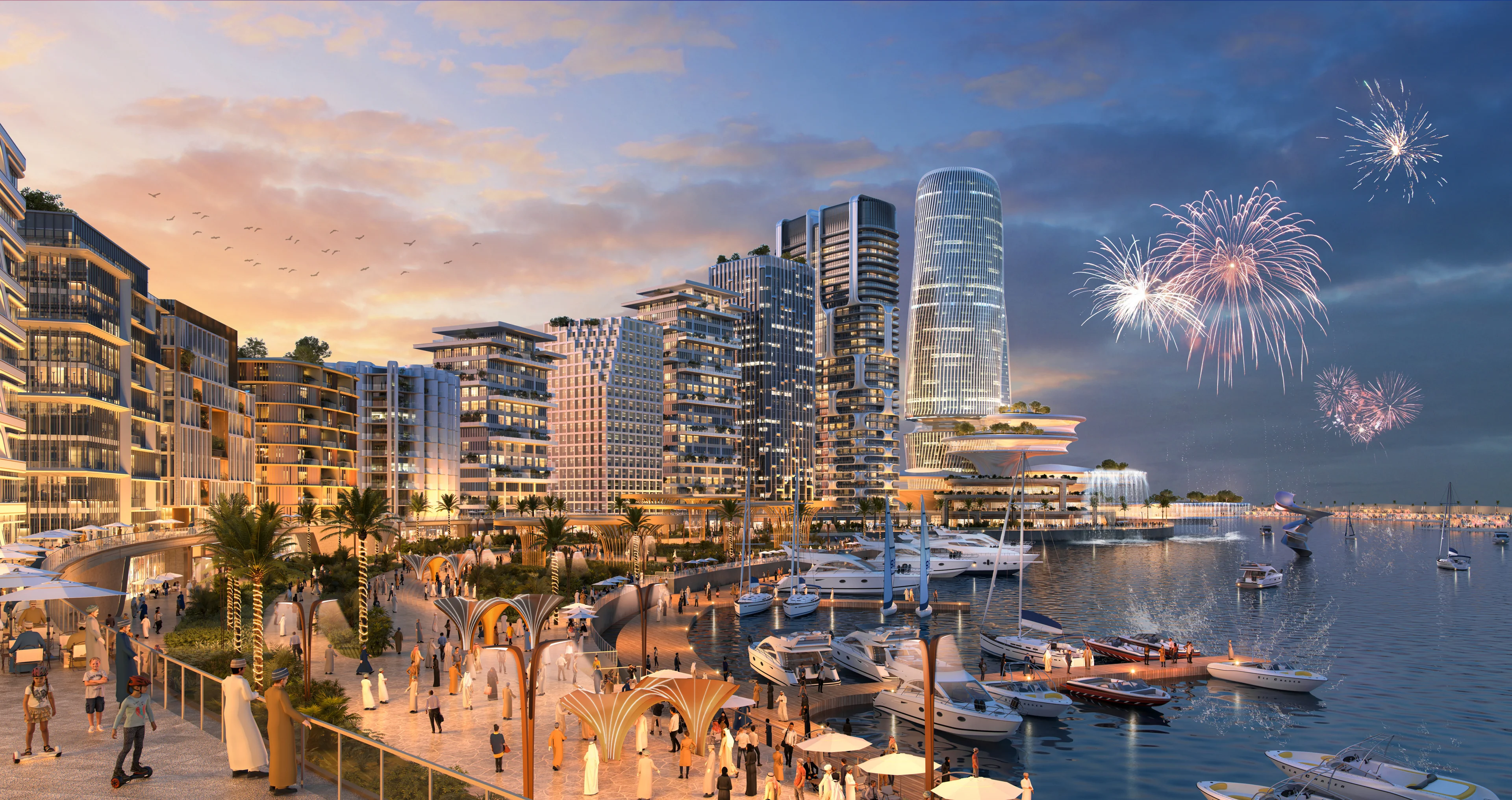
Located in the Futian District of the city, Huanggang Port currently serves 300,000 people crossing the border with Hong Kong each day. Situated at this key interchange within the Greater Shenzhen Bay region, the new Huanggang Port Area masterplan at Shenzhen Park in the Shenzhen-Hong Kong Science and Technology Innovation Cooperation Zone incorporates direct connections with Shenzhen’s metro network.
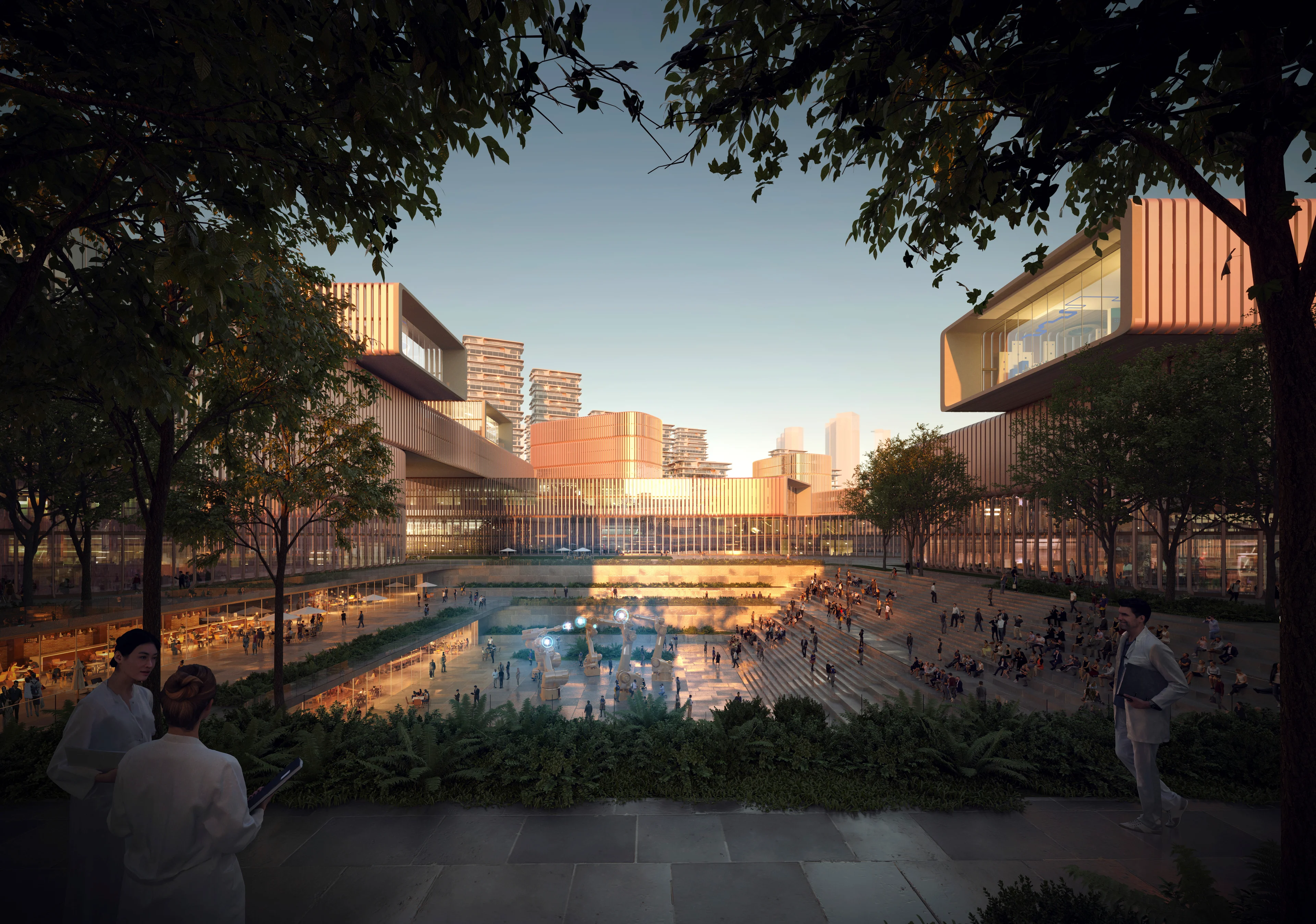
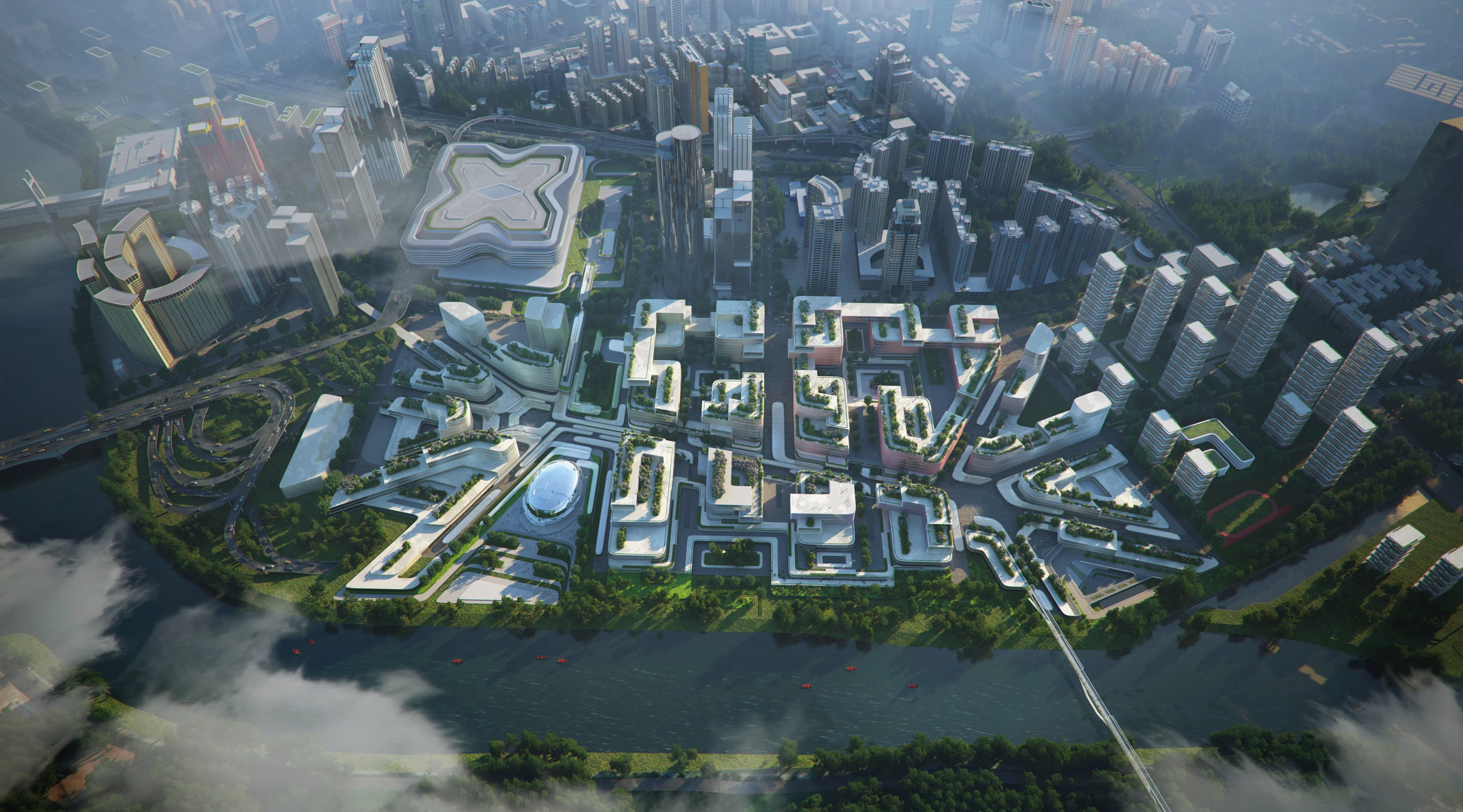
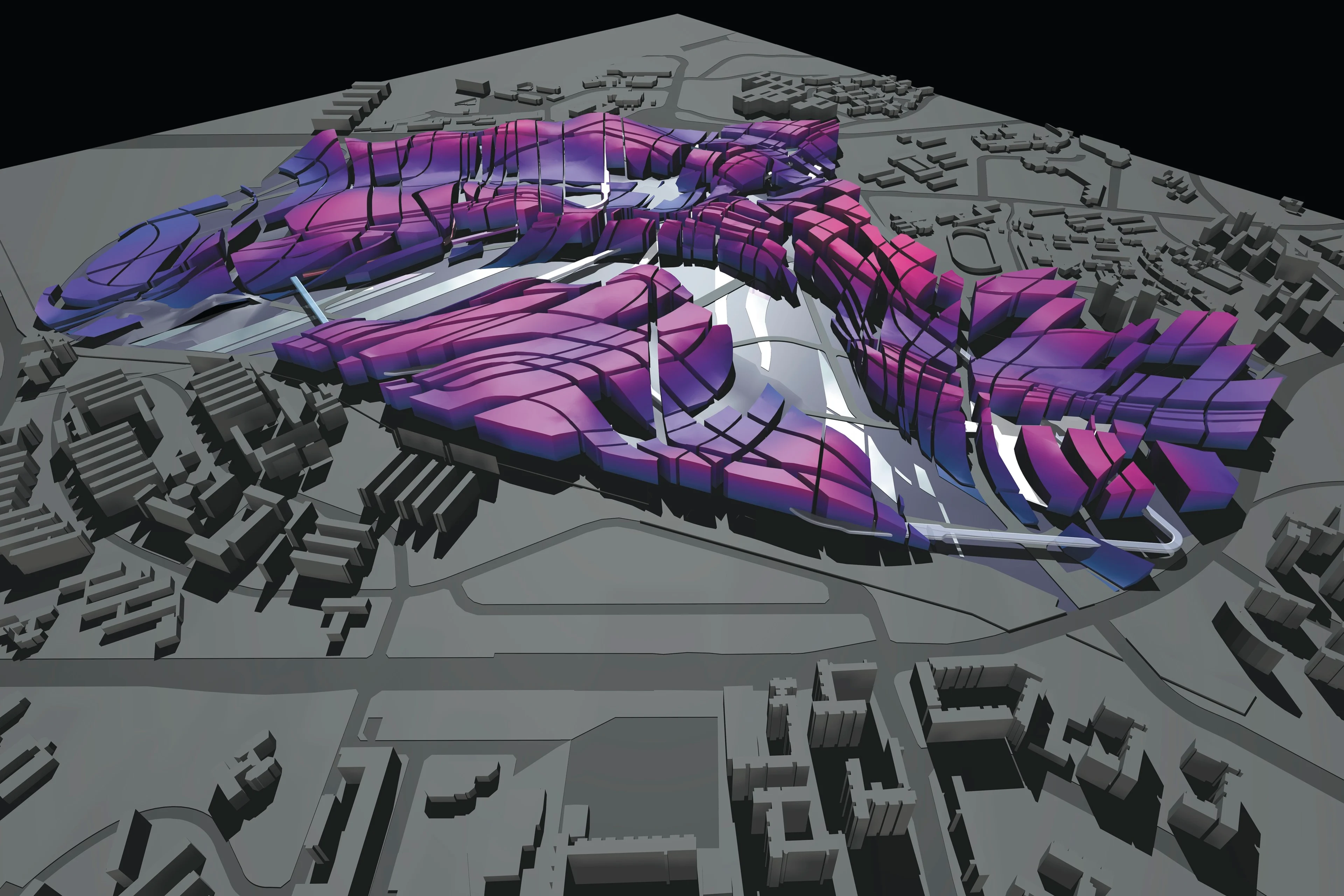
Centred around two large public plazas, the Huanggang Port Area masterplan defines three interconnected districts: the port hub, collaborative innovation area, and port living zone. The existing Huanggang port management area and public transport interchange at the south western end of the masterplan will be redeveloped as the ‘port hub’ district with administrative supporting offices and hotels for visiting scientists and researchers.
Render by Atchain
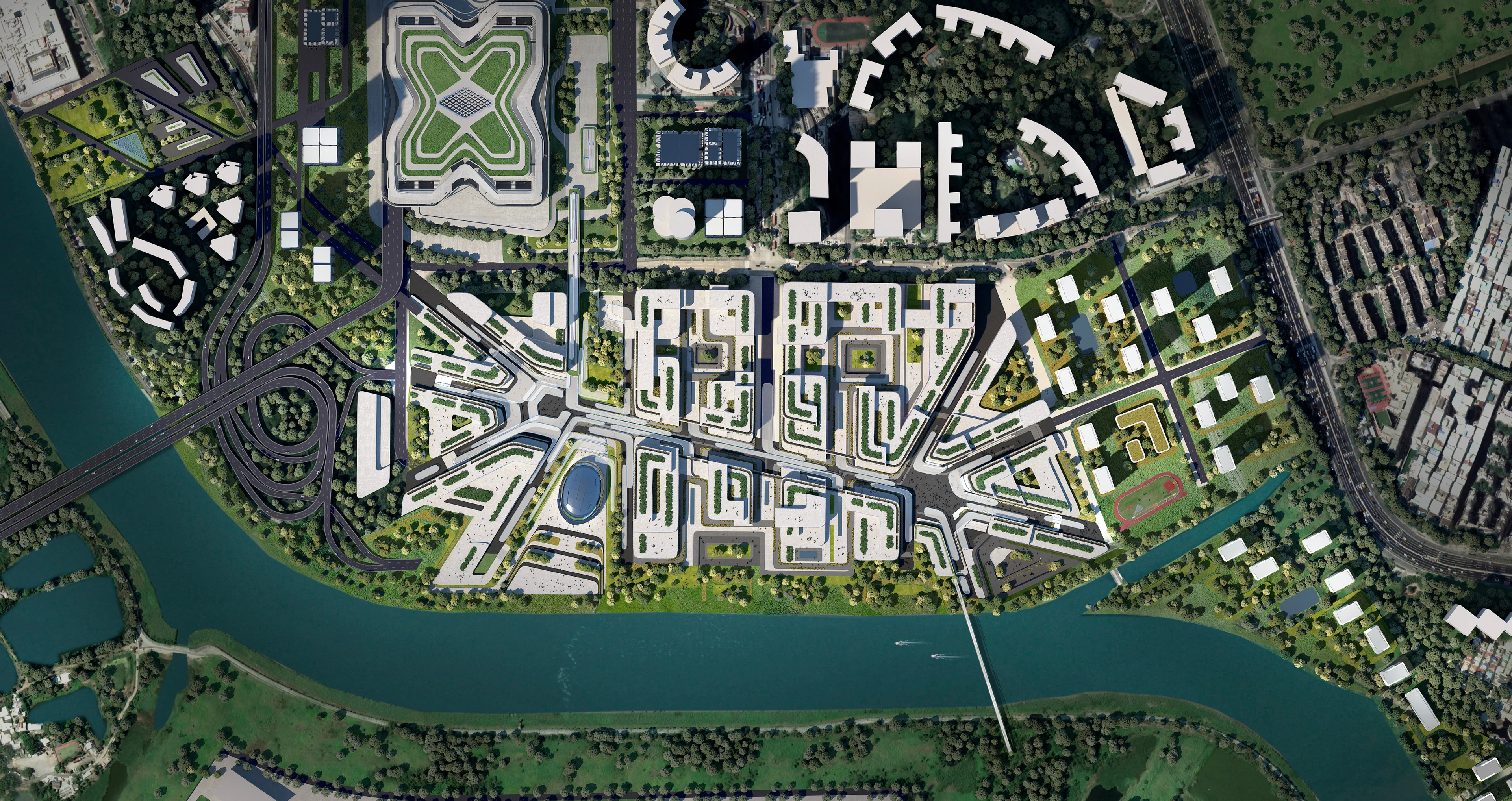
Masterplan
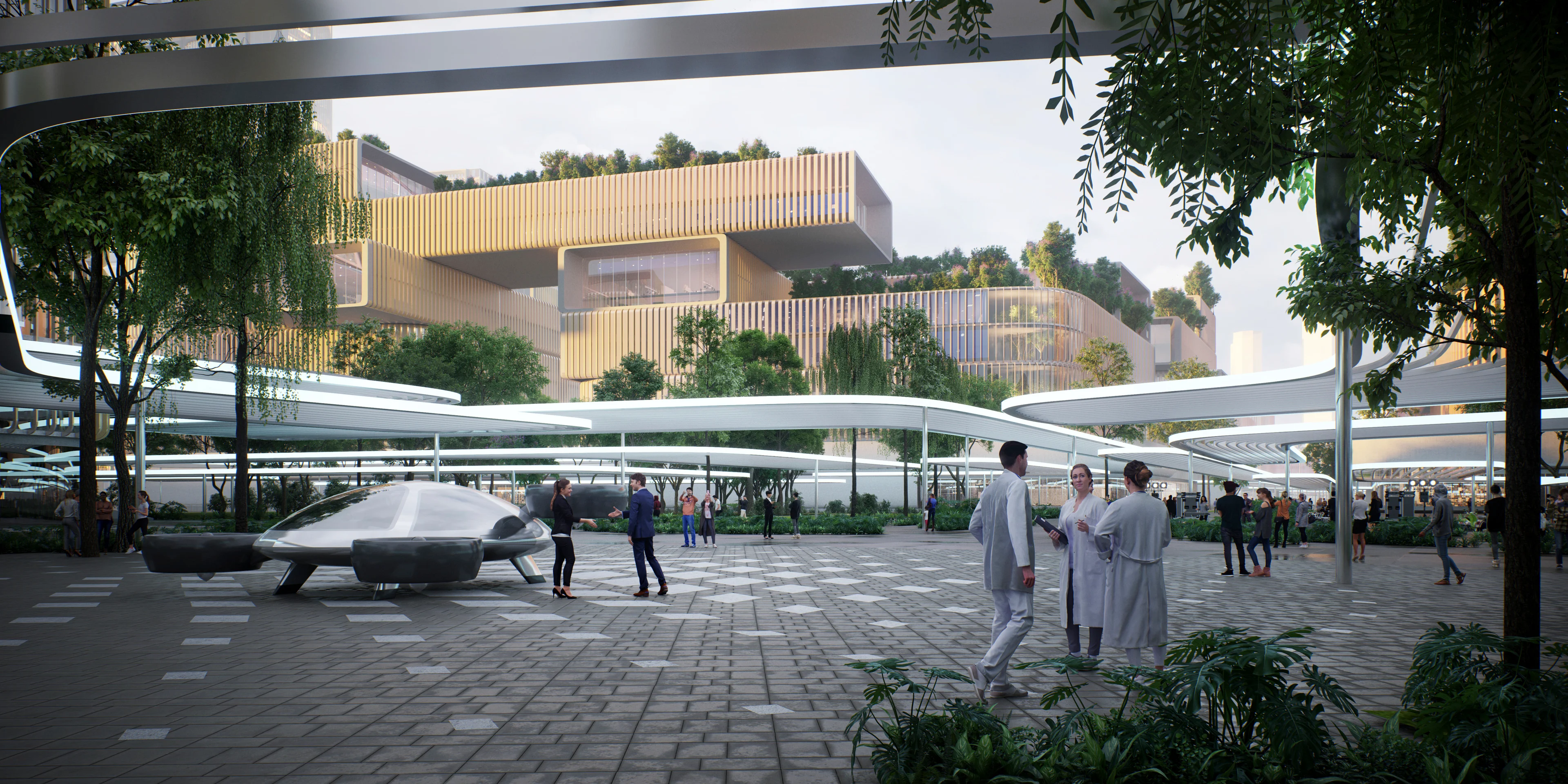
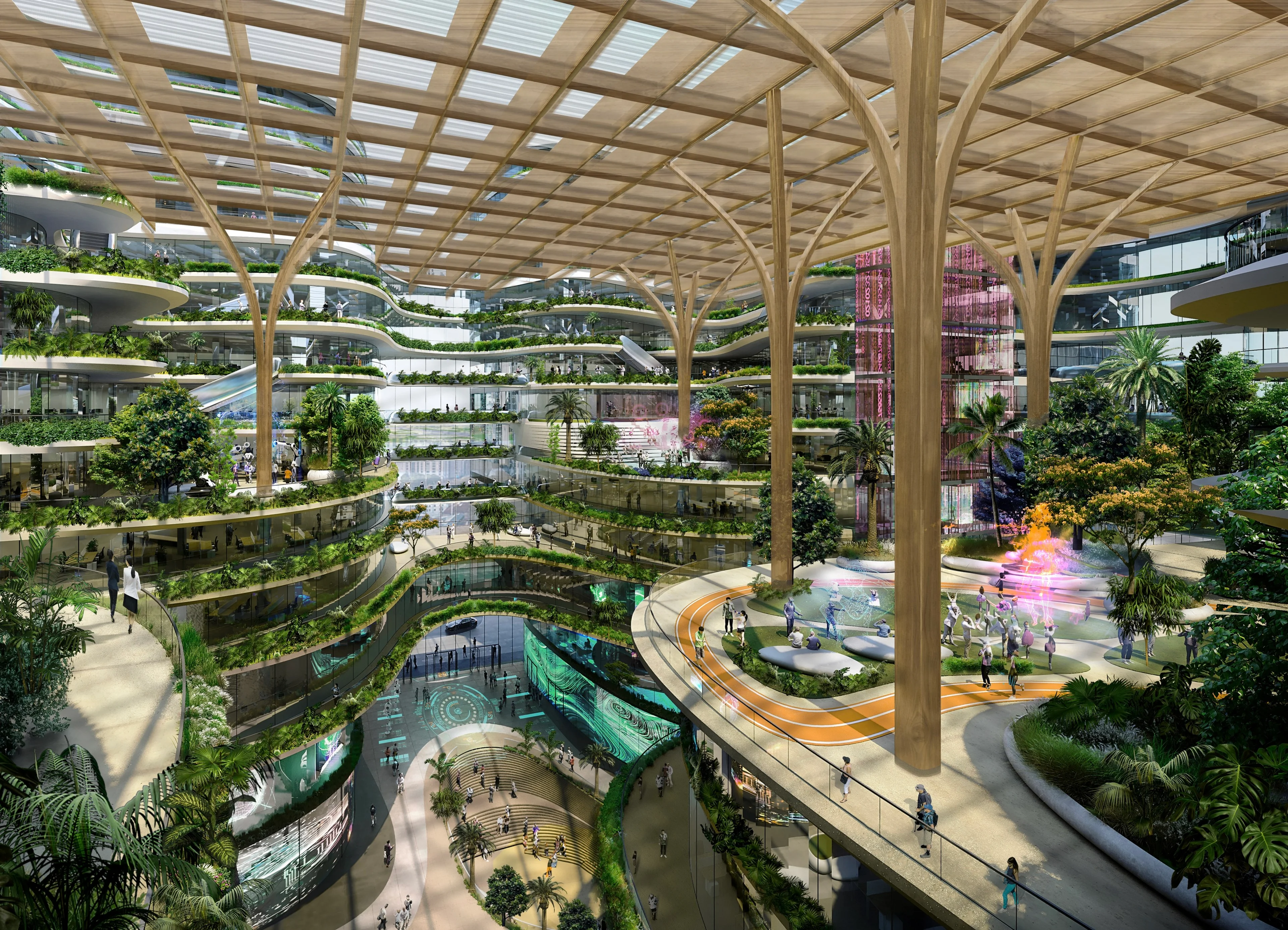
The port’s former cargo inspection areas and parking lots will be transformed as the ‘collaborative innovation’ area comprised of scientific research centres and laboratories as well as a conference centre to host lectures, talks and events that promote the exchange of ideas and collaboration.
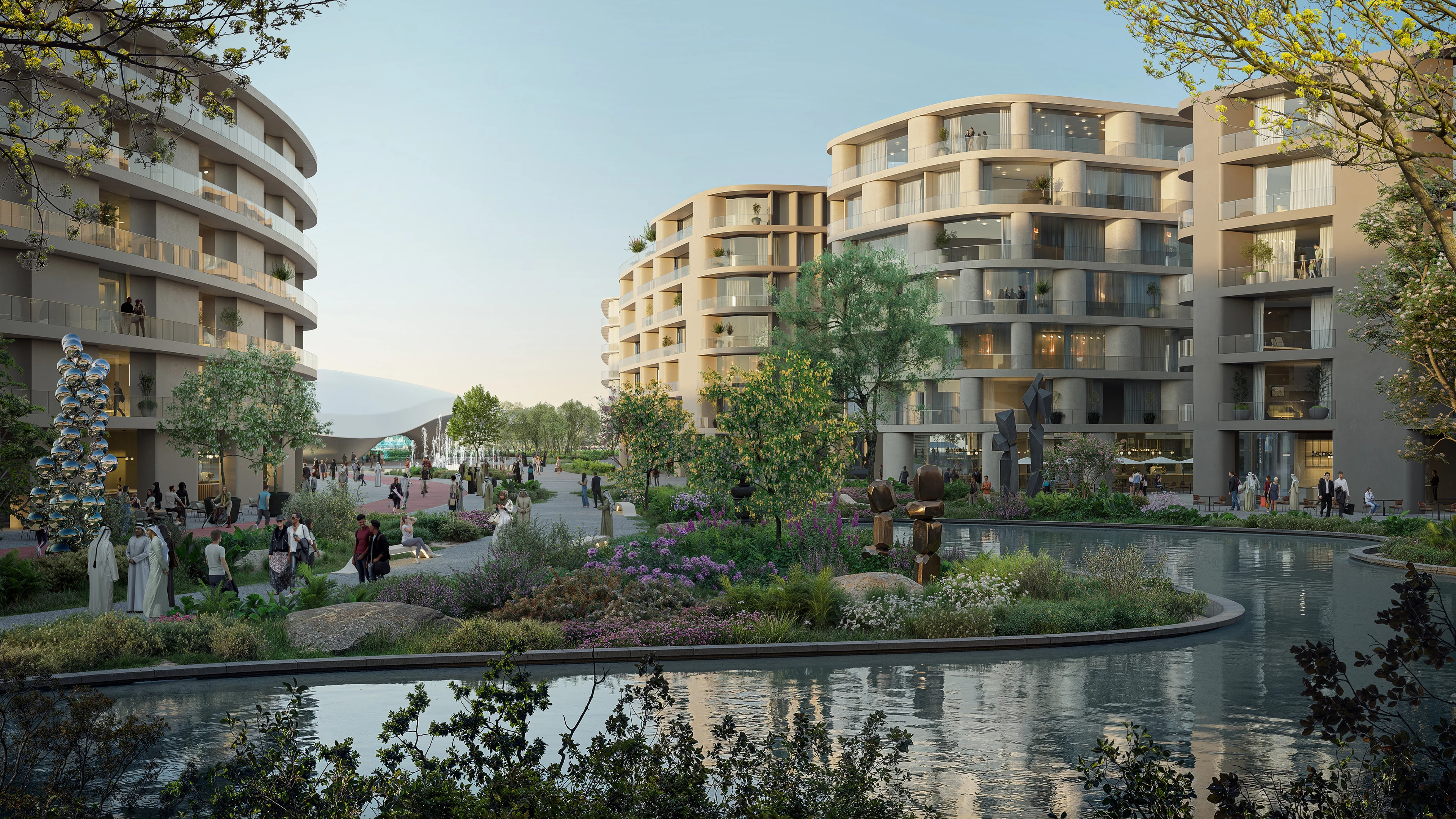
The ‘port living’ district will be located next to Fulin station of Shenzhen’s metro at the north eastern end of the masterplan and will encompass residential developments, schools, sports and recreational facilities as well as shopping and dining amenities for those working within the science park.
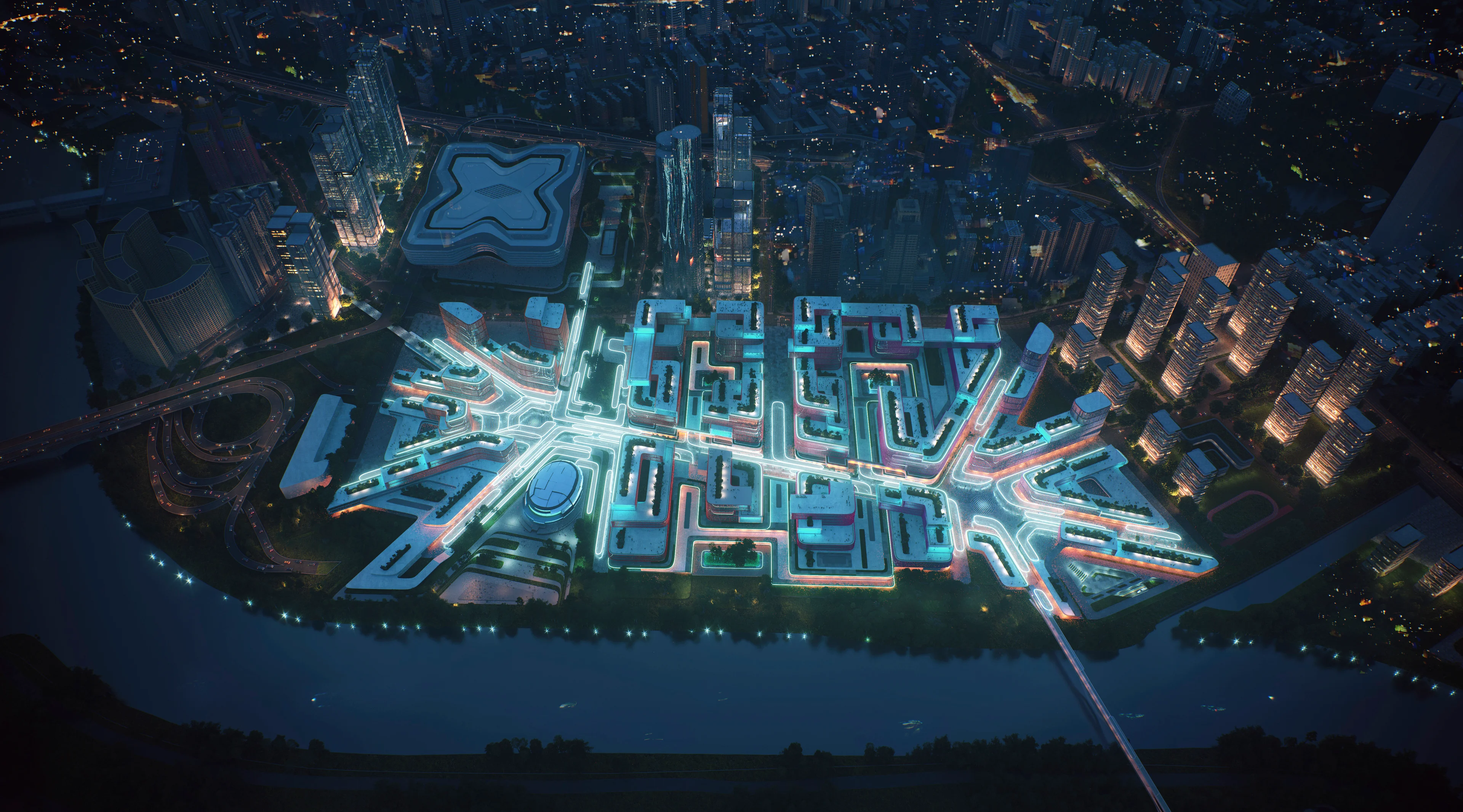
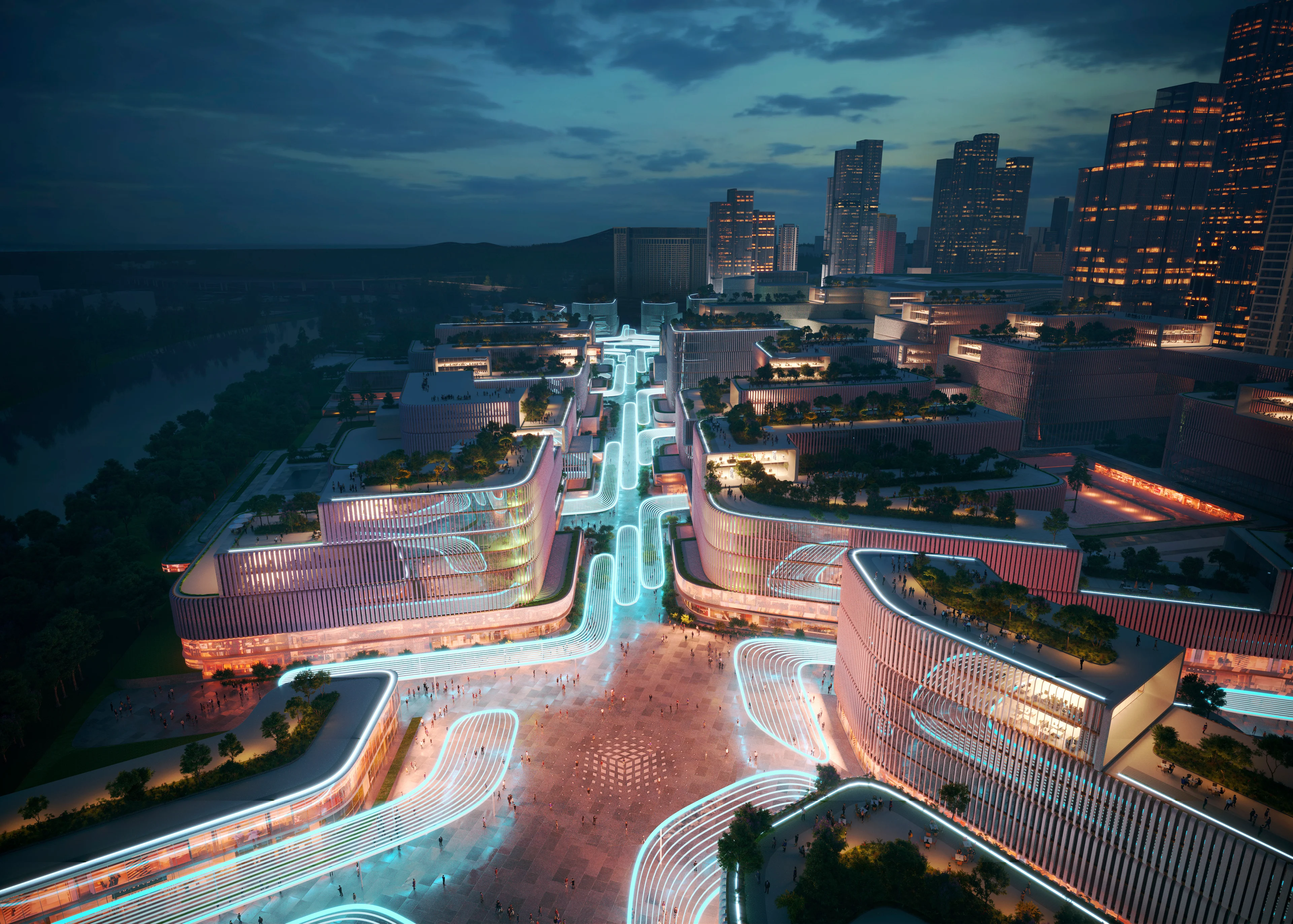
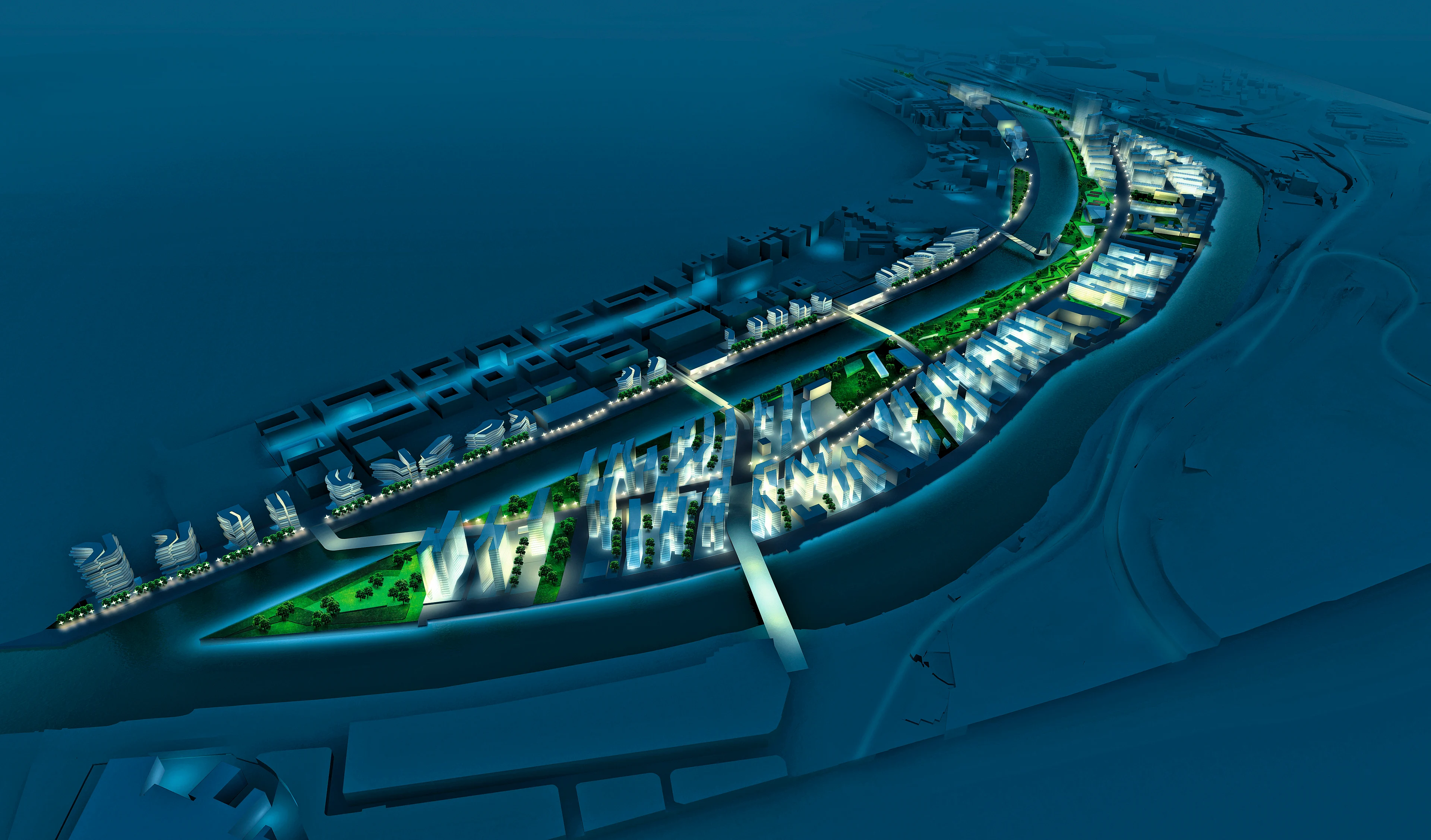
With its base grid established by Shenzhen’s existing street layout to the west, the masterplan’s central spine is a wide pedestrian boulevard that connects its two primary public gathering spaces: the civic plaza at Fulin metro station in the north east and the large public square in the centre of the administrative hub at the Huanggang interchange in the south west. A radial secondary grid centered on theses plazas further sub-divides the districts into clusters and creates additional circulation routes for functionality.
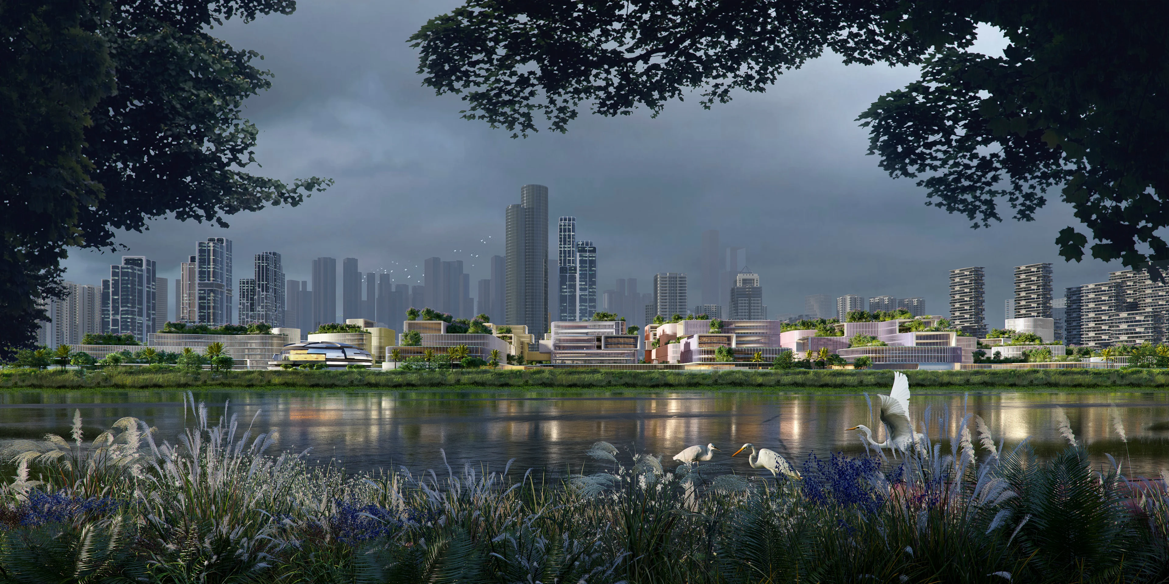
The design accommodates the future expansion of the research studios and laboratories via shared podiums and bridging skywalks connecting with adjacent buildings. In addition to the two primary civic plazas, each smaller cluster of buildings has its own ‘nucleus’ of an outdoor communal square ensuring spaces for nature are integrated throughout the masterplan that will also create a green belt of parklands and wetlands along the Shenzhen River.
Masterplan
From research and technology hubs in China and Malaysia to the Port of Tallin, discover our masterplans.
Render by X UniverseCG, courtesy of MoHUP
Masterplans
Designed by ZHA, the $1.3bn Al Khuwair Muscat Downtown and Waterfront Development will span 3.3 million m² and is set to revitalise the area.
Render by TegMark
Architecture
Masterplans
Designed by ZHA, the masterplan for Khalid Bin Sultan City is adjacent to BEEAH’s acclaimed headquarters in Sharjah.
Render by ZHA
Masterplans
The 582-acre Discovery City masterplan will be ZHA’s first project in Malaysia.
Bilbao north facing south night time
Masterplans
Refurbishment and construction of housing, new industries, tertiary uses, urban and recreational spaces and new connections linking the peninsula, city and surrounding areas.
Courtesy of ZHA
Conceptual mass form
Masterplans
Realising the avant-garde architect’s dream – of an urban architecture which truly embraces the spatial repertoire and morphology of natural landscape formations – One North takes shape, creates its own skyline, in Singapore – applying for the very first time, the concept of artificial landscape formation to an entire urban quarter.
Courtesy of ZHA, render by Negativ
Masterplans
The masterplan re-establishes and reinforces the links with the Port of Tallinn and the Old Town, as well as the links between the city and the sea; providing connectivity from the ferry and cruise terminals to the city centre, and at the same time creating an integrated new neighbourhood for the people of Tallinn.
Courtesy of ZHA, render by MIR
Start-up exhibition and conference centre
Masterplans
A mixed-use masterplan for 70,000 researchers, office staff, residents and visitors, Unicorn Island has been designed to enhance the well-being of its community; its design influenced by principles within the region’s historical natural engineering projects.
01
02
03
04
05
06
07
keyFacts
people
credits